Digital Soil Core™
Don't get stuck digging holes. Go digital with LandScan.
Digital Soil Core™
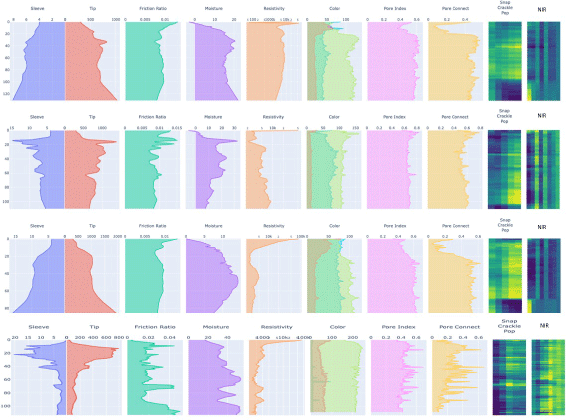
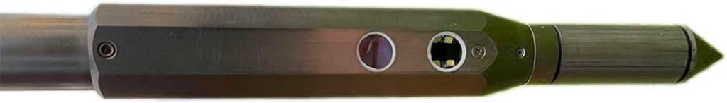
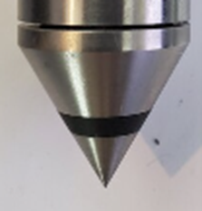
The Digital Soil Core (DSC) is a probe with 7 independent sensors that is pushed into the ground at a continuous rate that enables the DSC to characterize the full soil profile to a depth of 120cm+ in about 1 minute. The DSC is part of the LandScan Platform for Discovery site characterization and analysis system where it is digitally synchronized with other complimentary technologies. While LandScan is focused on agricultural applications of the DSC, there are many other applications outside agriculture as well.
Ways to Utilize the DSC
Understand Plant Performance and Behavior
The most powerful and unique use of the DSC is to calibrate remote sensing and understand the ‘why’ and ‘what to do next’ between the conditions that exist and the goals around production and environmental stewardship. If analytical quality remote sensing data is available, then the DSC can be used to develop a dynamic calibration and provide objective ground-truthing between plant performance and behavior and the growing environment. Crop classes created using spatial, spectral, and thermal information dimensions are used to target the investigation of the relationship between a plant and the soil in which it is growing. The DSC data profile is digitally synchronized with the Digital Vegetation Signature (DVS) which enables the discovery of associations not possible with analog or subjective data.
Exploratory, Discovery, and Research
The DSC can be used to investigate and monitor the soil-water profile relationship under different irrigation practices throughout a growing season or used to baseline and monitor soil carbon and health over time under different practices. It can be used to set up research plots to avoid data noise caused by changing soil conditions within plots or understand and account for the variability if it can’t be changed. If seeds, microbes, fertilizers, and irrigation technologies work differently in different soils then understanding the soils in which they are developed and tested will bring them to market faster and with more confidence.
Outside of agriculture, the DSC can be used for mineral exploration, natural landscape assessment, archeology, levee and dam investigations, and much more.
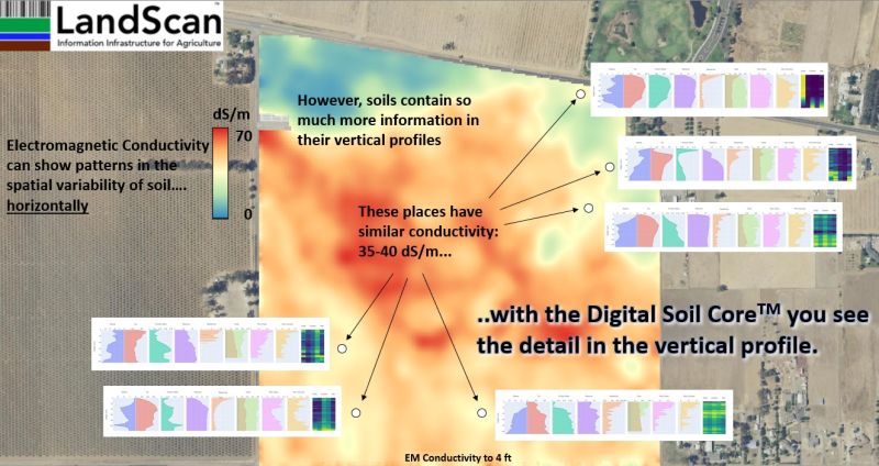
Geophysical Mapping
Sometimes you need a map of the soil and the current vegetation, or lack thereof, isn’t important. In these instances, LandScan may still utilize remote sensing for DSC location targeting, but we also integrate a best-in-class off-the-shelf electromagnetic induction (EM) sensor and obtain an initial screening of the response from this sensor integrated with high-resolution topography data. It is very important to further delineate the variability detected with the EM sensor, as equivalent EM responses very rarely guarantee identical soil profiles even within the same field.
DSC Sensors
Tip Force and Sleeve Friction
These two sensors work independently but are a powerful combination together and represent the first divergence of the DSC from ‘traditional’ methods used in agriculture. The American Society of Agricultural Engineers (ASAE) specification for penetrometers varies from the American Society of Testing and Materials (ASTM) specification. The ASAE penetrometer has one measurement (tip force) using a 30-degree tip angle vs the ASTM specification that utilizes a 60-degree tip. The ASTM measurement is obtained ‘downhole’ meaning the force measurement is isolated to the surface area of the tip (cone index). The 30-degree tip is designed to emulate root penetrability while the 60-degree tip is designed to distinguish better between varying stratigraphic layers.
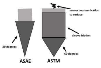
The ASAE measurement is taken ‘uphole’. The ASAE specification assumes that, because the rod used to insert the tip into the soil has a smaller diameter, that no friction occurs along the rod as it is inserted. If it did, then the measurement above would be a function of both tip resistance and friction along the rod. In reality, and in practice, there is always friction along the rod meaning the uphole measurement is unable to resolve the source of the force.
Another major difference is that the ASTM specification contains a sleeve sensor that measures friction, also downhole. This additional sensor enables the tool to separate bearing strength from cohesion, allowing the tool to properly attribute an increase in push resistance to a soil with more clay versus a soil with more sand. Is an elevated cone index associated with a change in density, or a change in texture? The ASTM specification can tell the difference whereas the ASAE tool cannot.
Dielectric Permittivity and Electrical Resistivity
Like the tip and sleeve, these two sensors are also independent of one another, but work closely together both in physical and data space. Measurement of both are performed at the tip of the DSC where they play an important role in the calibration and interpretation of the other sensors.
Permittivity is the ability of a material to store electrical potential energy under the influence of an electric field. LandScan has engineered a capacitance sensor that generates data useful for the precise estimation of water and other physical such as mineralogy and density. The electrical resistivity works with the permittivity sensor to measure salinity and can also be used to characterize clay content.
Acoustic Sensor
If you close your eyes and listen to someone walking on gravel, you can estimate the size of the gravel they are walking on. In much the same way, but with far more sophisticated acoustic sensing capability, the DSC ‘snap crackle pop’ sensor is used to estimate coarse fragments and distinguish between varying materials in the soil. There are many sound dimensions, most beyond the human’s ability to hear, obtained through advanced signal processing that tell LandScan something different about each different soil horizon. I encourage you to turn your sound up and listen to some rock music!
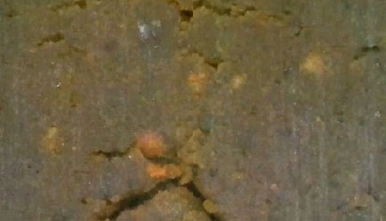
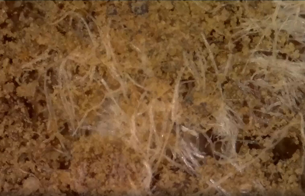
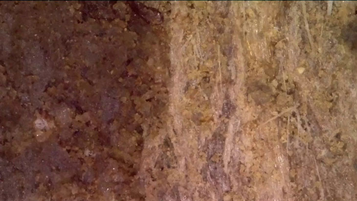
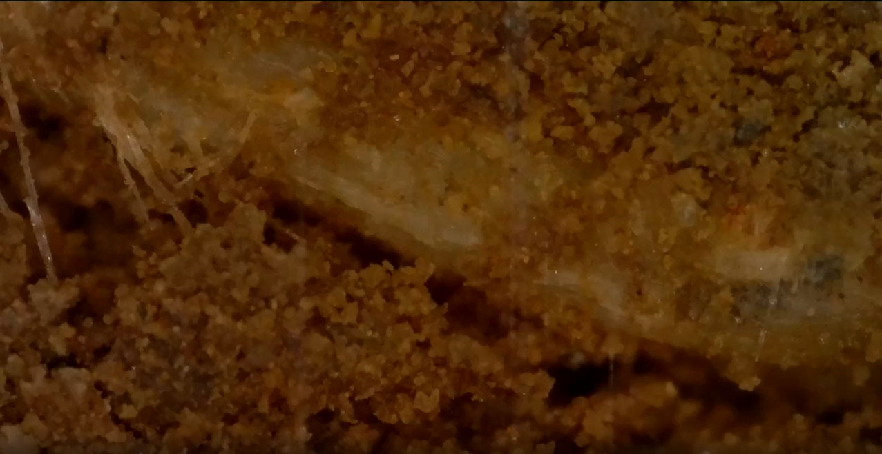
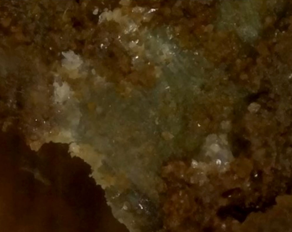
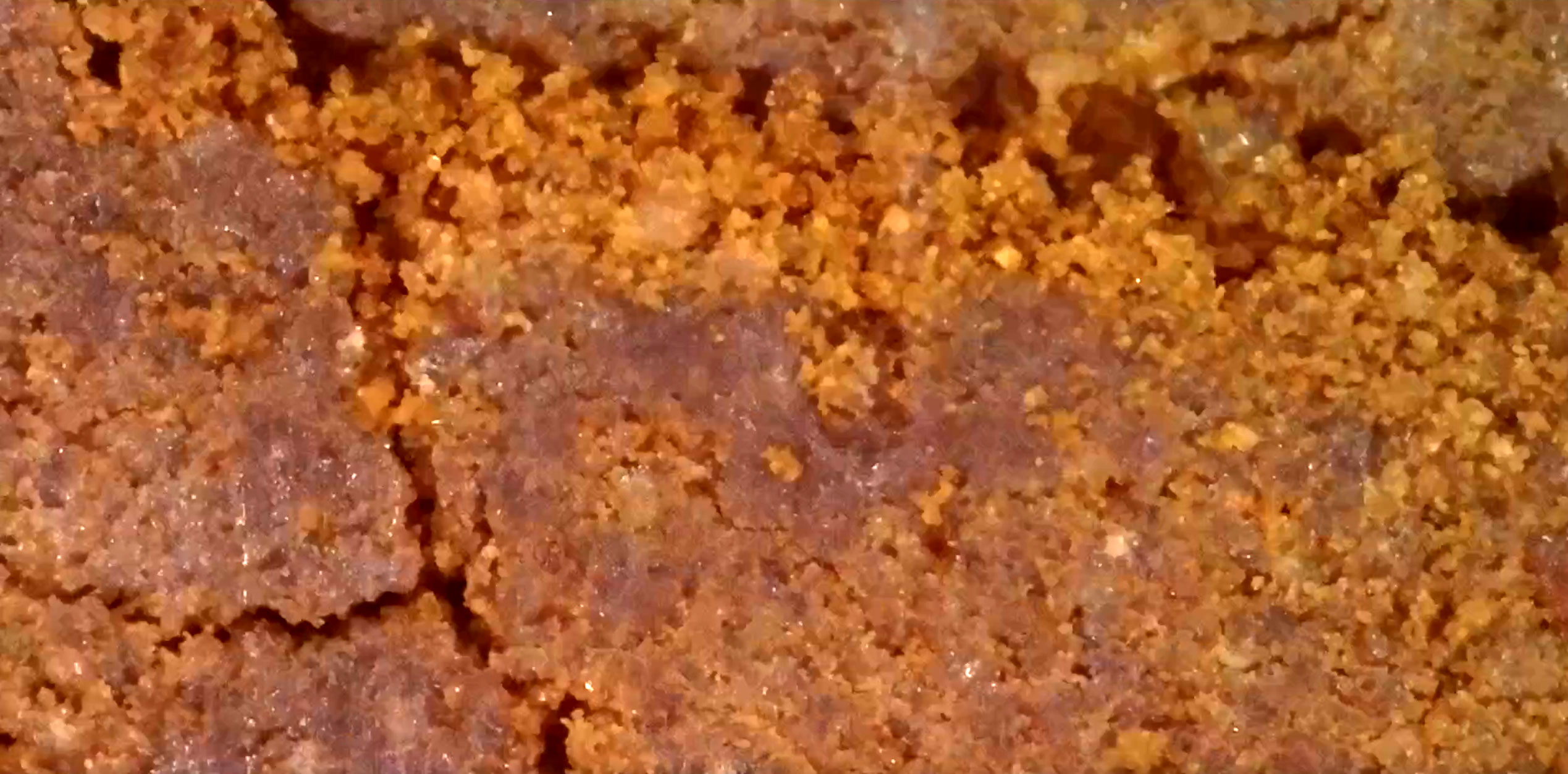
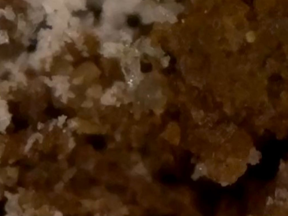
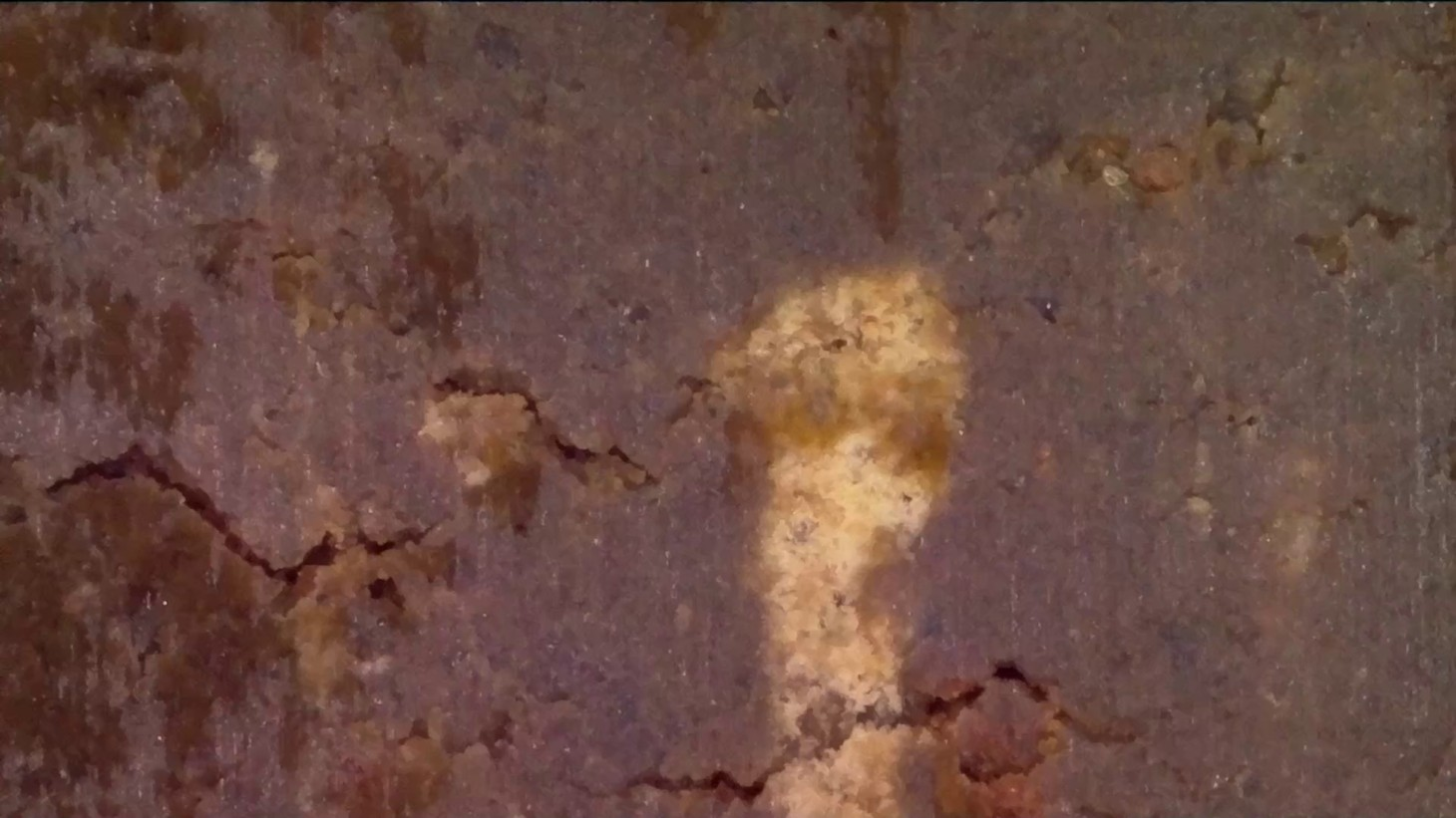
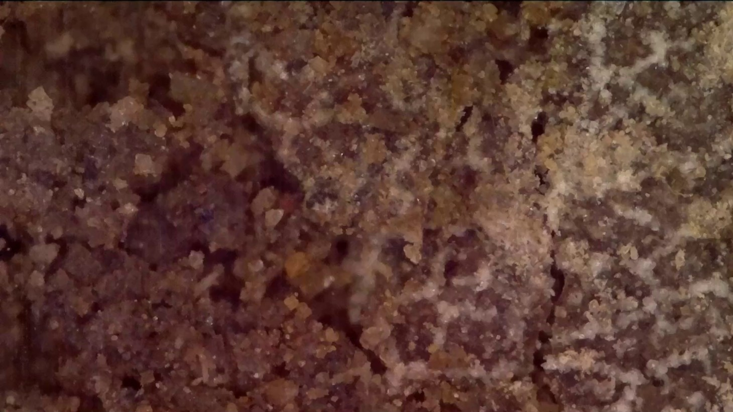
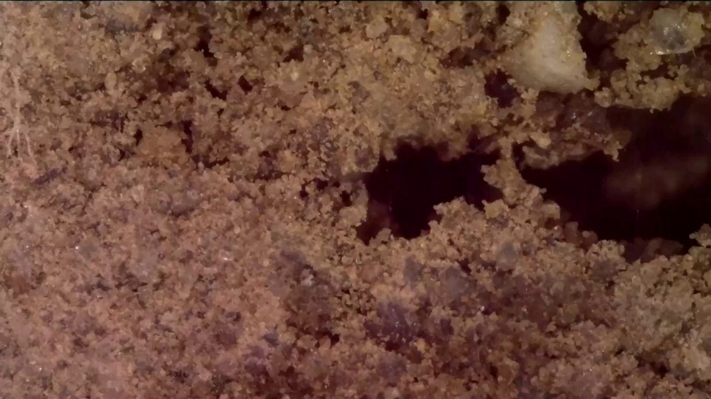
Digital Microscope
An image is worth a thousand data points! One of the most fascinating sensors on the DSC is the video microscope that enables LandScan to observe soil properties to a spatial resolution of 3 microns with a complete view of 2.3mm x 1.2mm in a continuous vertical transect of the soil profile. We see changes in color including redoximorphic features and horizon boundaries, but also features like cracks, pores, roots, minerals, individual soil grains, and even living organisms and other microbiome-related attributes.
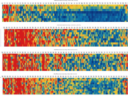
Visible and Near-InfraRed Diffuse Reflectance Spectroscopy
The most advanced sensor in the DSC probe in the spectroscopy sensor that measures the response of the soil from a spectrometer located above-ground from 400-2500nm in 3 nm bands. This incredibly rich data includes over 1200 bands of spectral data in a continuous profile to a depth of more than 120cm. The DSC is the only sensor in the world that incorporates both visible and NIR spectroscopy sensors combined with a soil moisture measurement simultaneously. This moisture data, along with information obtained from other sensors relating to texture, mineralogy, structure, density, and many other properties provide a wealth of complimentary components for further understanding the spectroscopy data.
The Power of 7 Sensors
Of course, the real power of the DSC comes from the synergies derived from having 7 independent sensors. Each sensor modality is orthogonal to the others, maximizing the information content available to characterize every centimeter of the soil profile.
Orthogonal sensor modalities are simply multiple ways of sensing the same phenomenon using different mechanisms. Think of your experience of a campfire. You see the flames by detecting the photons they emit, you feel the fire’s intensity by the long wave radiation reaching your skin, you hear its combustion by the sizzle and crackle reaching your ears, and you probably smell the smoke being generated. Each sense is an indirect measure of the fire in its own way, together they give you absolute confidence in the presence and intensity of the campfire. The orthogonality of sensor modalities is critical to correctly selecting between competing hypotheses. Imagine again feeling the heat of a campfire, but hearing the whir of an electric motor, smelling nothing, and seeing a blow dryer.
An extremely important consideration in our development of the DSC was consideration of the interplay of orthogonality and degrees of freedom. Degrees of freedom of an estimate is the number of independent pieces of information that went into calculating the estimate. When we account for the dimensionality of information within single sensors like video, audio, or spectrometry, the DSC provides over 1200 independent pieces of information for every centimeter of soil it encounters, enabling accurate quantification of numerous soil properties.
When, in contrast, you read claims that a handful of sensor channels, all exploiting the same sensing modality, can accurately quantify dozens of independent parameters, be very skeptical. Unless the output variables are very highly correlated, there are not enough degrees of freedom among the estimators to support the output. It is an ill-conditioned problem. If the output variables are highly correlated, then what value are they?
Some purveyors of single- or two-mode mapping solutions will claim that the magic of machine learning enables the creation of all this rich property information from a handful of inputs. Worth considering is that even sophisticated machine learning algorithms – in fact, especially sophisticated ML algorithms – are merely a collection of statistical models arranged hierarchically in a manner that exploits the mathematical principle of composability to tease out sometimes very complicated (and hopefully causal) relationships between variables. As such, they are still beholden to fundamental principles governing the limits of statistical inference. DSC, with its multiple orthogonal sensors and high data dimensionality, stands unrivaled for soil information content.
All sensors are indirect. Nothing literally measures the size of every soil particle or counts the carbon atoms in every gram, but DSC gets closer to the soil than anything else. And together, the orthogonality and dimensionality of DSC’s sensor data enable highly quantitative results.